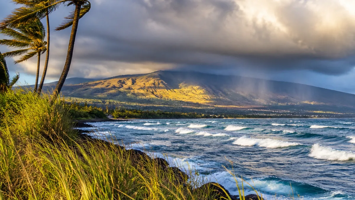
HILO — A band of moisture riding on fresh northerly to easterly winds will keep the Big Island in a pattern of clouds, wind and intermittent rain through Monday, according to local forecasts. Expect cooler nights at higher elevations, breezy afternoons along exposed shorelines and a split personality between windward and leeward sides.
What to expect Monday
Residents and visitors should plan for partly to mostly cloudy skies across much of the island, with scattered showers likely in windward communities. Leeward areas will generally be drier and sunnier, though isolated brief showers are still possible during the afternoon.
Winds will be noticeable. Northwest to north winds will reach up to 20 mph in some spots, especially near the Hilo coastline and other exposed northern shores. Eastern and upper-slope locales can expect gusty trades that will make the air feel cooler, particularly where upslope clouds linger.
Temperatures and elevation differences
Temperatures will vary sharply with elevation. Near sea level, highs on Monday will generally be in the low to upper 80s (86–91°F) on leeward Kona shores, while windward shoreline highs will hover closer to the low 80s. Mountain and high-elevation communities will be noticeably cooler — nights dipping into the 50s and low 60s around 4,000 to 5,000 feet.
| Area | Low (°F) | High (°F) | Notable winds |
|---|---|---|---|
| Hilo (shore) | 66–73 | 81–88 | Northwest up to 20 mph |
| Kona (shore) | 67–75 | 86–91 | Light to southwest up to 10 mph |
| Waimea / Kohala (shore) | 65–73 | ~82 | East trades up to 20 mph |
Rain chances by district
Precipitation will be uneven. Windward districts, including Hilo, Waimea and Kohala, will see the highest likelihood of showers — roughly a 50–70 percent chance in most forecasts — with a trend toward more numerous showers after dark in some upland areas. Leeward Kona is forecast to remain relatively dry, with only isolated afternoon or evening sprinkles and a lower chance of measurable rain.
- Hilo: Scattered showers through the night and into Monday; breeze strengthening in the afternoon.
- Kona: Mostly clear to partly sunny; isolated afternoon showers possible.
- Waimea & Kohala: Variable cloudiness and scattered showers, becoming breezier with increasing shower coverage overnight.
Mountain slopes will amplify these contrasts. Upslope flow fuels cloud formation on the windward flanks, while the leeward sides stay relatively stable and warm under breaking sunlight.
Practical impacts
For commuters and outdoor workers, stronger gusts near exposed ridgelines and shorelines could cause lighter debris to shift and make high-profile vehicles feel unsettled. Boat operators and recreational mariners should monitor localized conditions; whereas the Kona coast will generally be calmer, windward shorelines may experience choppier water with short-lived shower squalls.
Gardeners and farmers should expect modest rainfall in windward valleys that will help soils remain damp; leeward fields will see less relief. Hikers should be prepared for muddy trails on windward routes and cooler temperatures at elevation — layers and rain gear remain advisable.
The forecast pattern is not tied to any major storm system, but rather to the steady influence of trade and north-northwest winds nudging moisture onshore. Observers can expect the overall setup to persist into Monday night, when many windward locations may see more frequent showers.
For the most current conditions and any advisories—especially marine or high-wind statements—check the National Weather Service updates and local county bulletins before traveling or planning outdoor events.
Kai Meyerson, reporting from the windward flank of the island.