HONOLULU — A Wind Advisory will span most of Hawaii through Saturday as robust trade winds strengthen across the islands, the National Weather Service in Honolulu said Friday.
What to expect
Forecasters are forecasting persistent east-northeast winds in the range of 25 to 35 mph, with stronger gusts reaching near 50 mph in exposed locations. The advisory covers all islands except Kauai and Niihau and is scheduled to remain in effect from noon Friday until 6 p.m. Saturday.
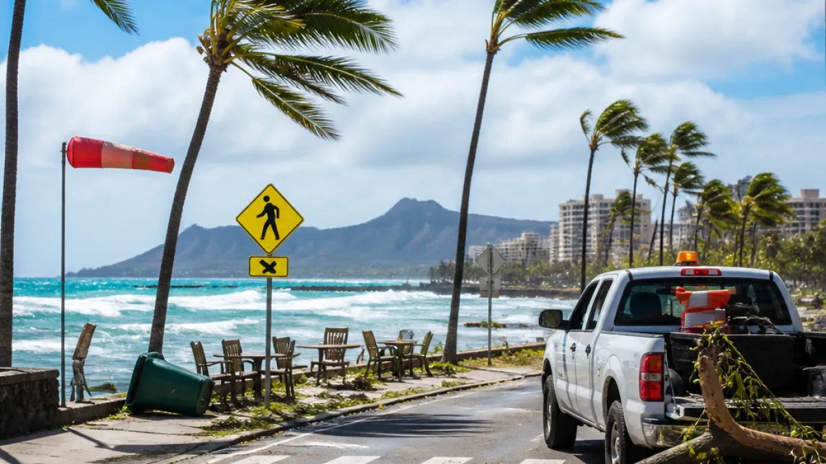
Winds of this magnitude are most likely to be felt in downslope zones, elevated summits and along ridgelines, as well as through terrain gaps and other areas that typically funnel the trade winds. Residents in coastal and windward communities should expect blustery conditions through the advisory period.
Local impacts and safety advice
Strong trades can have practical and immediate consequences for daily life and property. Officials warn that such winds have the potential to:
- Dislodge roofing materials and shingles;
- Break or uproot tree limbs;
- Blow away unsecured tents, canopies and patio furniture;
- Create hazardous driving conditions for high-profile vehicles such as trucks, vans and SUVs;
- Cause localized power outages if limbs contact power lines.
Public safety advisors recommend taking steps now to reduce risks: secure or store loose outdoor items, avoid parking beneath large trees, and be prepared to reduce travel or alter routes if debris or fallen branches obstruct roads. Those who use temporary structures for events should consider taking them down until winds subside.
Practical travel and outdoor guidance
Motorists — particularly those operating larger or taller vehicles — should exercise caution on exposed roadways and bridges. Gusty crosswinds can make handling more difficult, especially for drivers unfamiliar with the terrain. Boaters and recreational water users on the windward sides of islands should monitor marine forecasts and be prepared for higher seas and stronger onshore winds.
| Parameter | Expected values |
|---|---|
| Sustained winds | 25–35 mph |
| Gusts | Near 50 mph |
| Area covered | All islands except Kauai and Niihau |
| Effective | Noon Friday to 6 p.m. Saturday |
Be prepared for outages
Power interruptions are a realistic possibility when wind-driven branches contact distribution lines. Residents who rely on electrically powered medical devices should make contingency plans and keep batteries and backup supplies on hand. Those with generators should follow safe operation guidelines and ensure carbon monoxide alarms are functional.
When walking in gusty conditions, watch for falling limbs and flying debris. Securing garden furniture, potted plants and other outdoor items can prevent property damage and reduce hazards for neighbors and drivers.
Why trades are strengthening now
Trade winds in Hawaii ebb and flow with pressure gradients across the central Pacific and local topography. When the pressure difference increases, the trade flow accelerates. In this event, the orientation of the winds combined with the islands’ ridgelines and valleys will magnify gusts in familiar trouble spots.
While the advisory does not cover Kauai and Niihau, residents and visitors there should still be aware that localized wind enhancements can occur near leeward or windward features depending on the day’s exact wind direction and speed.
Keep an eye on updates from the National Weather Service and local officials. Conditions can change, and the advisory could be extended, expanded or rescinded based on evolving observations and model guidance.
For real-time information and weather products, consult the National Weather Service in Honolulu and local emergency management channels.